The Week in Review – 2026-40

🗺️ After having to postpone it twice, the latest feature in Bikerouter is now available: The new Layer Manager brings more order to working with overlay layers.
Some of the new features:
- Default layers can now be removed
- Layers can be renamed freely (using the button or by double-clicking)
- Layers can be sorted (using drag and drop or the arrow buttons)
- Layers can be grouped into folders
- Entire folders can be enabled and disabled; the opacity of all layers in a folder can also be adjusted at once
- The order in which layers are displayed on the map follows their order in the Layer Manager
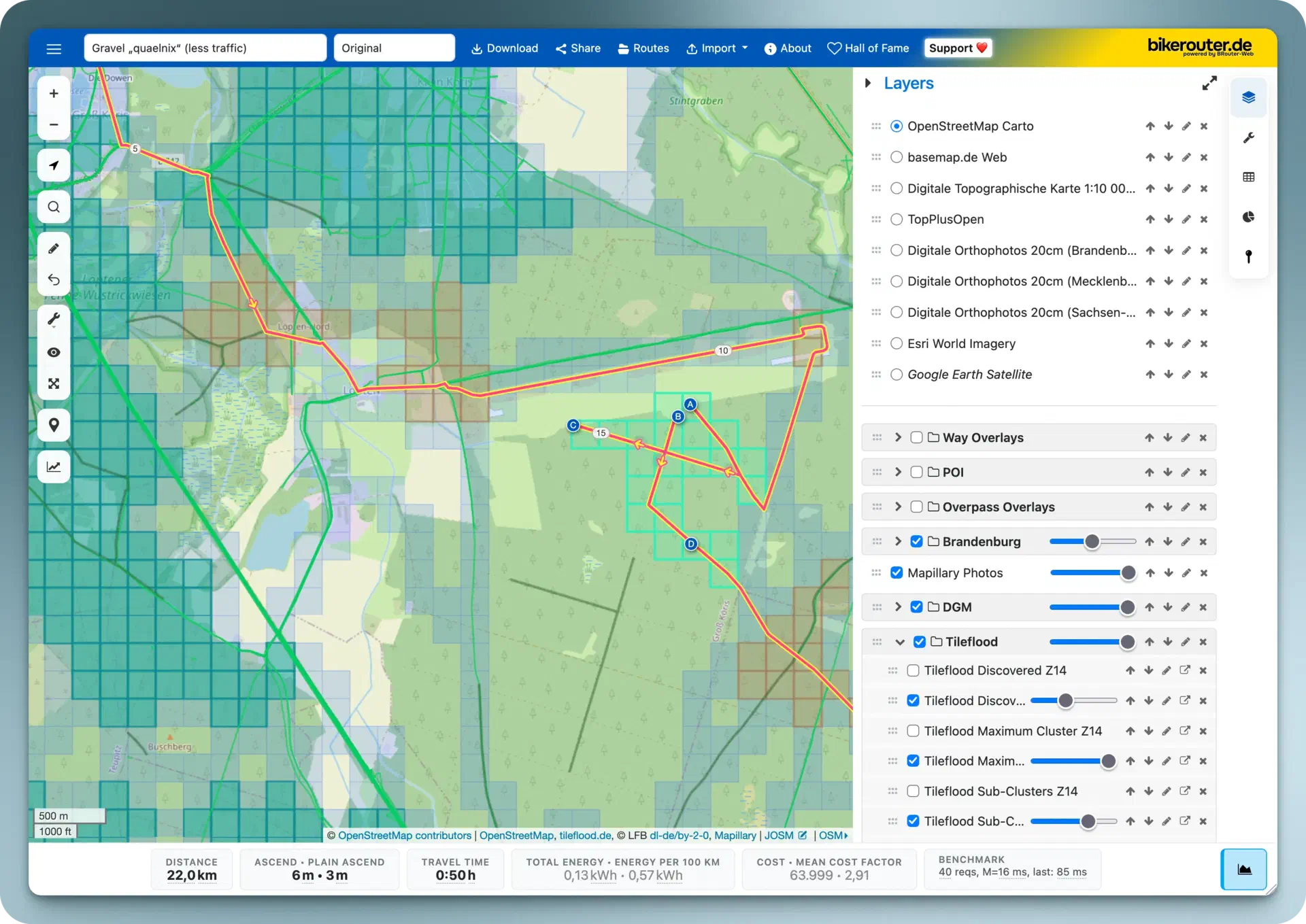
I also recorded a short screencast briefly demonstrating the most important features: Bikerouter: Working with layers and releasing the new Layer Manager (YouTube).
There were also a few bug fixes. Among other things, special characters (such as
>, <, *, ?, etc.) are now removed from file names when downloading.
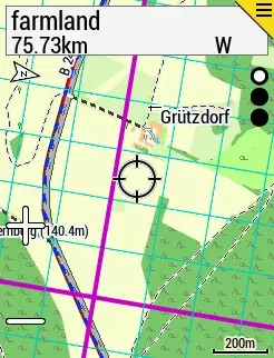
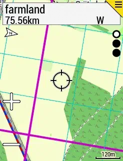
🔲 For collecting map tiles (“Squadrats,” “Tilehunting”), I have now created a map layer that can be displayed on the Garmin Edge1. This layer shows the map tiles at zoom levels 14 and 17 (“Squadrats” and “Squadratinhos”) on top of the normal map view.
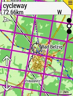
All you need to do is load the .img file onto the Garmin, into the same folder
containing all the other map files. The tiles will be displayed on top of the
map the next time it starts. If that does not work immediately, the map layer
first needs to be enabled in the device settings.
Only the static tile grid is displayed; your personal progress is not shown. The idea behind this is that while I am out, I only want to quickly determine whether I have already crossed a tile boundary.
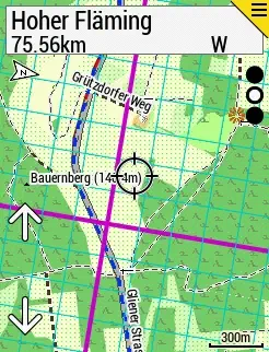
I also built an iOS app for this a while ago and have already partially integrated it directly into the route while planning with Bikerouter, but this is even easier: The phone stays in my pocket because a glance at the display is enough, and I no longer need to draw additional straight lines when planning a route.
If you are interested, the files can be downloaded here: Garmin maps.
I created one map for Germany (6 MB) and one for Europe (226 MB).
🪚 The “installing three-phase power and Ethernet for the workshop” project is slowly progressing. Over the weekend, I installed some of these plastic cable ducts in the utility room here in the house. They will contain the cable connecting the workshop to the house. In the process, I had to work around several inside and outside corners.
There are matching corner pieces for the ducts that can be used for this, but I did not have any lying around. So I had to make miter cuts.
I definitely did not want to do that with a handsaw. I thought about it briefly and then remembered that ages ago, I had bought a bandsaw blade for non-ferrous metals and plastic.
It turned out to be ideal for the task: With the fence set to 45°, I produced perfectly fitting miters in record time.
For dust extraction, I used the regular shop vacuum because I want to dispose of the plastic shavings separately and do not want them in the large dust extractor. Depending on the type of wood, the wood shavings that usually accumulate are useful for the compost, for example.
🗺️ The popular smartphone app “StreetComplete” is now also available for iOS via TestFlight.
It is still buggy here and there, but already quite usable. Definitely a very long-awaited release!
(In the meantime, I had even bought a second SIM card for an Android phone, partly so that I could conveniently use StreetComplete while out and about.)
GitHub issue, including the TestFlight link.
🎨 CSS Bed
This is a collection of classless CSS themes to use as starting points in web development.
CSVW is a standard for describing and clarifying the content of CSV tables.
and
Use CSVW to annotate CSV files with JSON metadata.
It sounds slightly offbeat, but would certainly make some things easier.
🔊 Listened to this week:
- TeamTURBO – MARIE CLAIRE - TeamTURBO Newcomercast
- Alyne – Alyne @ Wilde Möhre Festival 2026
- Balance Music – John 00 Fleming: Live from Balance Croatia 2026
- CosmiKat – CosmiKat @ Fase Gathering // 14.6.26 // Dark Psytech & Psytrance
- The Island Festival – nøvae @ The Island Festival 2026
-
works also for other Garmin devices, of course ↩︎
Questions or comments?
Reply directly on Mastodon and your answer will show up here. Comments are only loaded from the Mastodon server after you click.